You have not yet added any article to your bookmarks!
Join 10k+ people to get notified about new posts, news and tips.
Do not worry we don't spam!

Post by : Anis Farhan
For centuries, humans relied on simple observations of the sky, wind, and seasonal cycles to predict the weather. Farmers, sailors, and travelers made decisions based on instinct, experience, and folklore. But as societies grew more complex and natural disasters posed increasing risks, the need for accurate, science-based forecasting became essential. Today, satellites orbiting high above the Earth provide that much-needed perspective. They are our eyes in the sky, gathering vast amounts of data that fuel modern weather predictions and climate research.
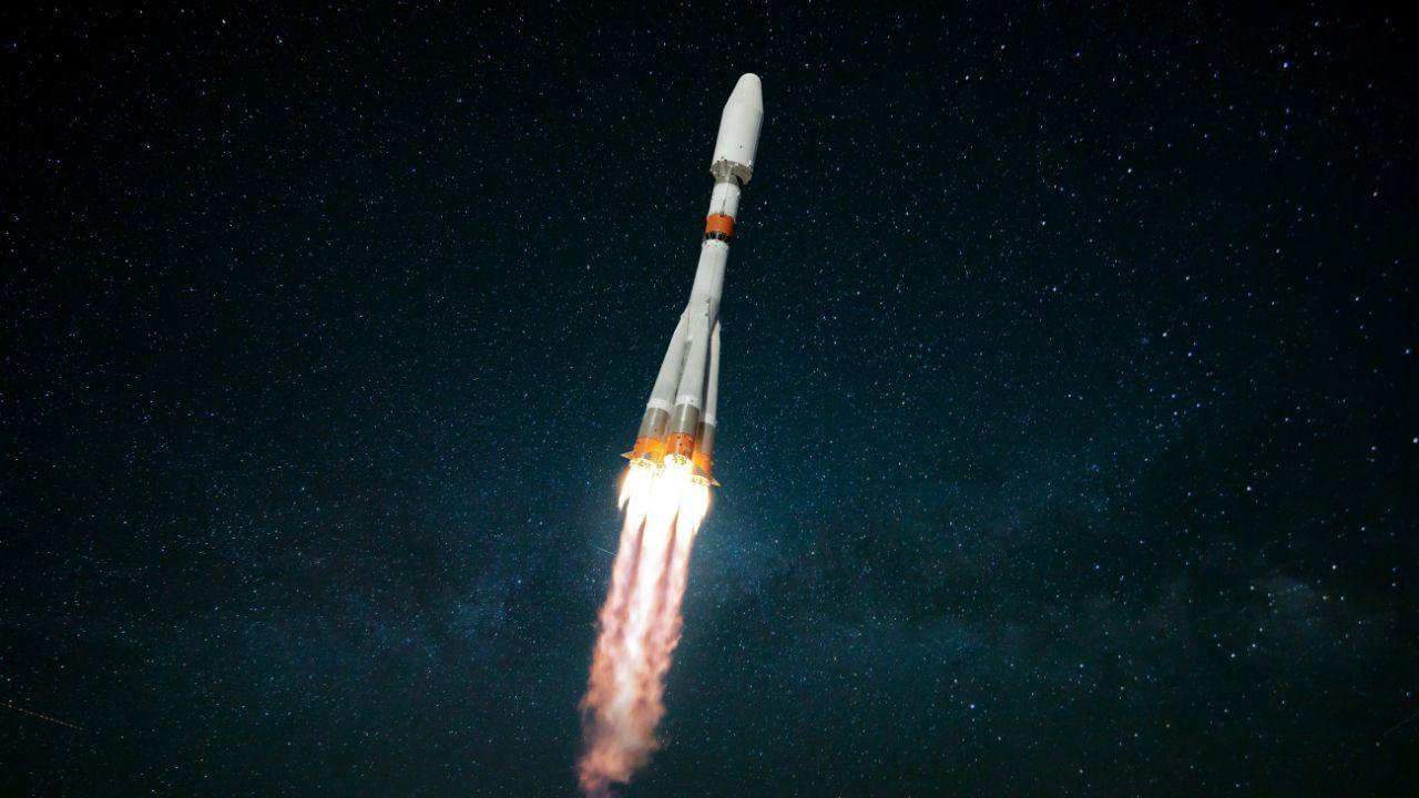
The story of satellite meteorology began in the mid-20th century, with the launch of the first weather satellite, TIROS-1, by NASA in 1960. Its grainy black-and-white images of cloud patterns were groundbreaking at the time, offering a view of Earth that was impossible from the ground.
Over the decades, satellite technology evolved dramatically. Early satellites could only provide limited snapshots, but today’s sophisticated systems deliver continuous streams of data, tracking weather systems across every part of the globe. This has revolutionized how meteorologists forecast weather and issue warnings for storms, floods, and heatwaves.
Weather satellites are broadly classified into two categories:
Geostationary Satellites: These orbit the Earth at about 36,000 kilometers above the equator, remaining fixed over one spot. They provide continuous coverage of large regions, making them ideal for monitoring storms and long-term weather systems.
Polar-Orbiting Satellites: Flying much closer to Earth, at around 850 kilometers, these satellites circle the planet from pole to pole. They capture detailed snapshots of smaller regions and eventually map the entire globe as the Earth rotates beneath them.
Both types are crucial for accurate forecasting. Geostationary satellites offer real-time monitoring, while polar-orbiting ones provide high-resolution data for localized studies.
Satellites are more than cameras in space. They carry a variety of instruments that measure different aspects of Earth’s atmosphere and surface. Some of the key data include:
Cloud Patterns and Movements: Vital for predicting storms and rainfall.
Sea Surface Temperatures: Used to forecast cyclones and track phenomena like El Niño.
Atmospheric Moisture and Pressure: Crucial for short-term weather models.
Wind Speeds and Directions: Measured by observing cloud motion or through microwave sensors.
Radiation and Energy Balances: Help track global warming trends.
This information is transmitted back to Earth, where meteorologists analyze it using powerful computer models.
Before satellites, weather forecasts were often vague and unreliable. Storms could catch entire populations off guard. Today, thanks to satellite data, meteorologists can predict hurricanes days in advance, giving governments time to issue warnings and evacuate people from vulnerable areas.
Forecast accuracy has improved dramatically in the last few decades. For example, five-day forecasts today are as reliable as two-day forecasts were just 30 years ago. This leap in accuracy is largely due to satellite observations feeding advanced climate and weather models.
One of the greatest contributions of weather satellites is disaster preparedness. Consider the case of cyclones in the Indian Ocean or hurricanes in the Atlantic. Satellites provide continuous tracking of storm paths, wind speeds, and potential landfall zones. Governments then use this data to evacuate communities, prepare relief operations, and minimize loss of life.
Satellites also play a critical role in detecting wildfires, monitoring droughts, and assessing flood damage. In regions where weather stations are sparse, especially in oceans or remote areas, satellites often serve as the only reliable source of information.
Weather satellites are indispensable for agriculture. Farmers depend on seasonal forecasts to plan sowing and harvesting. Long-term predictions of rainfall, soil moisture, and temperature trends help prevent crop failures.
In drought-prone regions of Africa and Asia, satellite-based early warning systems guide farmers and policymakers in preparing for water shortages. This directly impacts food security, as better forecasting means fewer crop losses and more efficient use of resources.
Beyond daily weather, satellites also monitor long-term climate trends. By recording sea-level rise, melting glaciers, and atmospheric carbon dioxide, satellites provide hard evidence of global warming. These observations form the backbone of international climate agreements and strategies to combat environmental change.
For example, data from NASA’s Aqua and Terra satellites, as well as the European Space Agency’s Sentinel missions, have been instrumental in tracking greenhouse gas emissions and global temperature changes. Without satellites, our understanding of climate change would be severely limited.
Modern satellites are equipped with increasingly advanced instruments. Hyperspectral sensors can analyze hundreds of wavelengths of light, providing unprecedented details about atmospheric composition. Machine learning and artificial intelligence are now used to process satellite data faster, improving both accuracy and speed of forecasts.
New generations of satellites are also smaller and cheaper, making it possible for even smaller nations to launch their own weather-monitoring systems. The rise of private space companies has accelerated this trend, ensuring that satellite-based forecasting will only get better in the coming years.
Despite their strengths, satellites face limitations. Cloud cover can sometimes obscure readings, and maintaining satellites in orbit is costly. Moreover, while satellites provide global data, local forecasting still requires ground-based observations to verify and refine models.
There is also the challenge of managing the growing amount of data. With thousands of images and readings collected every day, the need for advanced computing and data analysis has become critical.
Looking ahead, weather satellites will become even more central to human survival. Plans are underway to create constellations of small satellites that provide real-time, high-resolution coverage of the entire planet. Combined with artificial intelligence, these systems could predict extreme weather events with greater precision than ever before.
In the near future, we might see storm warnings issued not just hours, but days in advance, with exact predictions of intensity and impact zones. This would revolutionize disaster management and save countless lives.
From predicting tomorrow’s rain to tracking global climate shifts, satellites are the backbone of modern meteorology. They have turned weather forecasting into a science of precision and reliability, ensuring that communities can prepare for natural disasters, farmers can protect crops, and governments can safeguard economies.
As satellite technology continues to evolve, humanity stands better prepared to face the challenges of both everyday weather and long-term climate change. Our eyes in the sky will remain essential guides in navigating an uncertain world.
This article is for informational purposes only. Readers are encouraged to follow official weather advisories and updates from meteorological agencies for accurate and region-specific forecasts.


Shubman Gill Targets 2027 ODI World Cup Glory
India captain Shubman Gill says winning the 2027 ODI World Cup is the team’s ultimate goal after the
North Korea Fires Missiles Toward Sea
North Korea launches about 10 suspected ballistic missiles toward the Sea of Japan amid US–South Kor

UAE Launches Federal Budget Yearbook 2026
UAE Ministry of Finance unveils Federal Budget Yearbook 2026 highlighting AED92.4bn balanced budget

Sabalenka Storms Into Indian Wells Final
World No.1 Aryna Sabalenka beats Linda Noskova 6-3, 6-4 to reach the 2026 Indian Wells final, settin
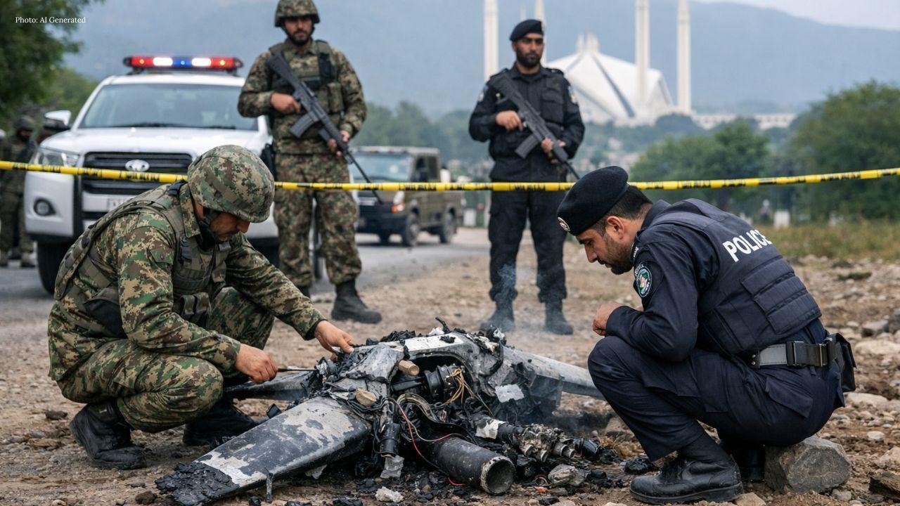
Explosive Drones Intercepted Over Islamabad
Pakistani security forces shoot down two explosive-laden drones in Islamabad days after threats from
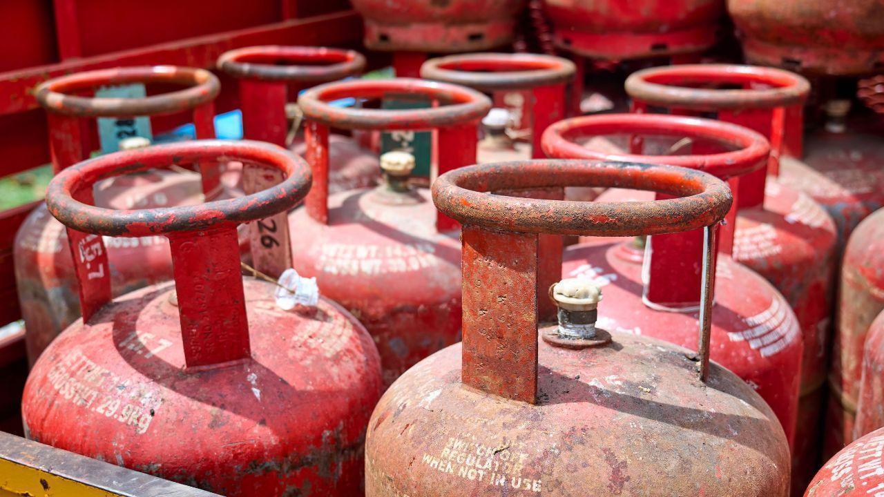
West Asia Crisis Sparks LPG Panic in India
West Asia conflict triggers panic booking of LPG cylinders across Indian cities, causing supply dela